VEĽKÝ VÝBER
Ponúkame milióny kníh v angličtine. Od beletrie až po tie najodbornejšie odborné.
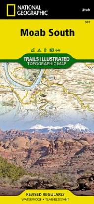
| ISBN | 9781566953566 |
|---|---|
| Autor | National Geographic Maps |
| Vydavatel | Natl Geographic Maps |
| Väzba | Folded |
- Waterproof - Tear-Resistant - Topographic Map
Expertly researched and created in partnership with local land management agencies, National Geographic's Trails Illustrated map of Moab South provides an unparalleled tool for exploring this iconic landscape. Whether your preferred mode of transportation through this wilderness is a mountain bike, whitewater raft, ATV, Jeep, or your own two feet, you'll appreciate the unmatched detail and useful information offered on this map. The print map includes Canyonlands National Park, Dead Horse Point State Park, and Canyon Rims and Sand Flats recreation areas, as well as detail of the Moab / Poison Spider Mesa / Gemini Bridges / Hurrah Pass area.
Particular attention is shown to the extensive trail systems in the area. Information on mountain bike and Jeep trails, including the scenic White Rim Trail includes their difficulty rating, mileage, and location. A listing of popular hiking-only trails is included, and the western portion of Kokopelli's Trail that traverses the region is highlighted. Trail use and mileages between intersections are clearly marked. River mileage on the Colorado and Green rivers is noted as well, for those exploring by boat. The map base includes contour lines and elevations for summits and passes. Some of the many recreation features include campgrounds, trailheads, river access, boat launches, amphitheaters, and scenic overlooks.
Every Trails Illustrated map is printed on Backcountry Tough waterproof, tear-resistant paper. A full UTM grid is printed on the map to aid with GPS navigation.
Other features found on this map include: Canyonlands National Park, Glen Canyon National Recreation Area, Hatch Point, Manti-La Sal National Forest, Mineral Point, Soda Springs Basin.

Ponúkame milióny kníh v angličtine. Od beletrie až po tie najodbornejšie odborné.

Poštovné už od 2,99 € a pri objednávke nad 60 € doprava na pobočku Zásielkovne zadarmo

Ceny kníh sa snažíme držať pri zemi a vždy pod cenou odporúčanou vydavateľom, aby si ich mohol kúpiť naozaj každý.

Získali sme certifikát "Overené zákazníkmi" na Heureka.sk. Prezrite si naše recenzie

Môžete využiť online chat, email alebo nám zatelefonovať.